
 Webcontent-Anzeige
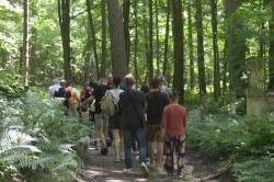
Ścieżka dydaktyczna "Góra Brusno"/The "Góra Brusno" educational trail
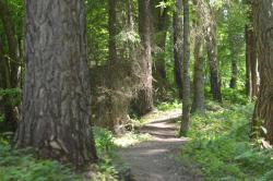
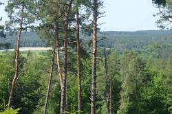
Ścieżka dydaktyczna "Góra Brusno", zlokalizowana na terenie leśnictwa Polanka, powstała z myślą o turystach, którzy lubią leśne spacery i chcą poznać lokalną przyrodę i historię
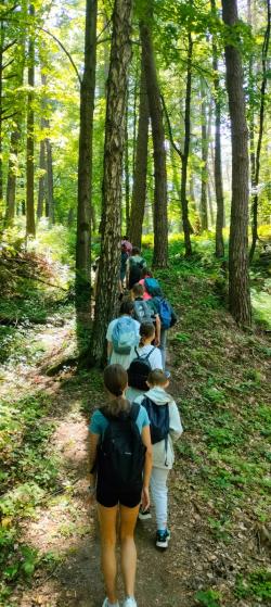
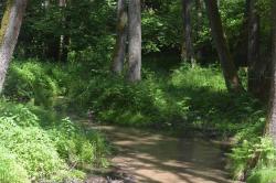
Trasa ścieżki prowadzi przez dolinę Brusienki, nad którą przerzucono dwa mostki, oraz zboczem góry Brusno.
Na trasie ścieżki znajduje się 15 przystanków z tablicami informacyjnymi o miejscowych obiektach historycznych, ciekawostkach przyrodniczych i historii gospodarki leśnej.
Przejście całej ścieżki (łącznie pętla 1 i pętla 2 ma długości ok. 4,5 km) zajmie Ci ok. 2-3 godziny.
Możesz skrócić trasę wybierając tylko pętlę 1 (długość trasy ok. 1,2 km, czas przejścia ok. 45 min.)
Podczas pokonywania trasy będziesz musiał wejść na górę Brusno (podejście z przewyższeniem ok. 100m). W pobliżu tablicy nr 7 i 8 znajdziesz ławeczki, na których możesz odpocząć. Potem będzie już "z górki".
The "Góra Brusno" educational trail, located in the Polanka forest district, was created for tourists who enjoy walks in the forest and wish to discover local history and nature.
The trail route runs through the Brusienka valley, over which two bridges have been constructed, and along the slope of Brusno mountain.
The trail features 15 stops with informative boards describing local historical sites, natural curiosities, and the history of forest management.
Completing the entire trail (loops 1 and 2 combined, totaling 4.5 km) will take approximately 2-3 hours.
You may shorten your route by selecting only loop 1 (1.2 km, approximately 45 minutes).
While traversing the trail, you will climb Brusno Hill (an ascent with an elevation gain of approximately 100 meters). Near stops 7 and 8, benches are available for resting. Afterward, the trail becomes easier and leads downhill.
resources-to-get
-
 Welcome to the educational trail Góra Brusno! (PDF, 14,8MB)
-
1. FORMER GREEK CATHOLIC PARISH CEMETERY (PDF, 33MB)
-
2. THE FORMER CHURCH SITE IN BRUSNO STARE (PDF, 55,4MB)
-
3. FACTS ABOUT THE LYNX (PDF, 5,8MB)
-
4. BRUSNO STARE – THE HISTORY OF A VILLAGE THAT NO LONGER EXISTS (PDF, 34,2MB)
-
5. ASH-ALDER RIPARIAN FOREST (PDF, 30,3MB)
-
6. THE RUINS OF ST. NICHOLAS CHAPEL (PDF, 21,3MB)
-
7. FORTIFICATIONS OF THE MOLOTOV LINE (EN, DE, UA, RU) (PDF, 301MB)
-
8. PILLBOX 06-SB-10 (EN, DE, UA, RU) (PDF, 99,3MB)
-
9. ROZTOCZE GORGES (DEBRZE) (PDF, 39,3MB)
-
10. THE BRUSNO STONEMASONRY TRADITION (PDF, 50,3MB)
-
11. HISTORY OF THE FORESTS (PDF, 63MB)
-
12. PROTECTED PLANT SPECIES FOUND ON MOUNT BRUSNO (PDF, 17,4MB)
-
13. WOLF (PDF, 906k)
-
14. GENERAL INFORMATION ABOUT POLISH BATS (PDF, 44,6MB)
-
15. BATS FOUND IN THE LUBACZÓW FOREST DISTRICT (PDF, 70MB)